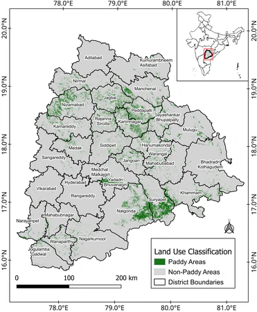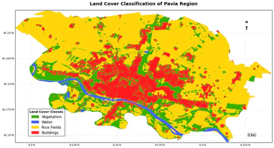
Satellite-Based Conservation Agriculture Monitoring Using Sentinel-1 SAR and Sentinel-2 in Pavia Rice Fields
A proof-of-concept study classifying post-harvest conservation agriculture practices in 75 rice fields (382 ha) across Pavia Province, Italy, using Sentinel-1 SAR and Sentinel-2 …
•
1 min read