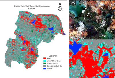
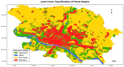
Multi-Sensor Land Cover Classification in the Pavia Region Using Google Earth Engine
This project implements a land cover classification system for the Pavia region in Italy, utilizing a fusion of Sentinel-1 and Sentinel-2 satellite data within the Google Earth …
•
4 min read